Almaden Quicksilver County Park is a popular destination for hikers with 37 miles of trails. Operated by Santa Clara County, the 4,163 acre park features remnants of mining operations among oak woodland, grassland, and shrub plant communities.
Almaden Quicksilver County Park is notable for its history in mercury mining. Mercury, sometimes referred to as “quicksilver,” was extensively mined here starting in the mid-1800s. The metal was used in gold and silver extraction processes across California. Remnant structures from this mining history can still be seen along certain sections of the park.
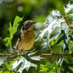
While Almaden Quicksilver Park is popular year round, spring time, when temperatures are not too cold or hot, is probably one of the best times to hike here. The extensive grasslands are host to a widespread bloom of wildflowers during the spring. As breeding and nesting season arrives, the sights and sounds of bird activity is heightened.
McAbee Trailhead
The McAbee Road trailhead is located at the edge of a suburban neighborhood in south San Jose where McAbee Road meets Whispering Pines Drive (37.214697744542306, -121.88148478277999). This entrance to Almaden Quicksilver is fairly popular on the weekends but during the week street parking is fairly accessible.
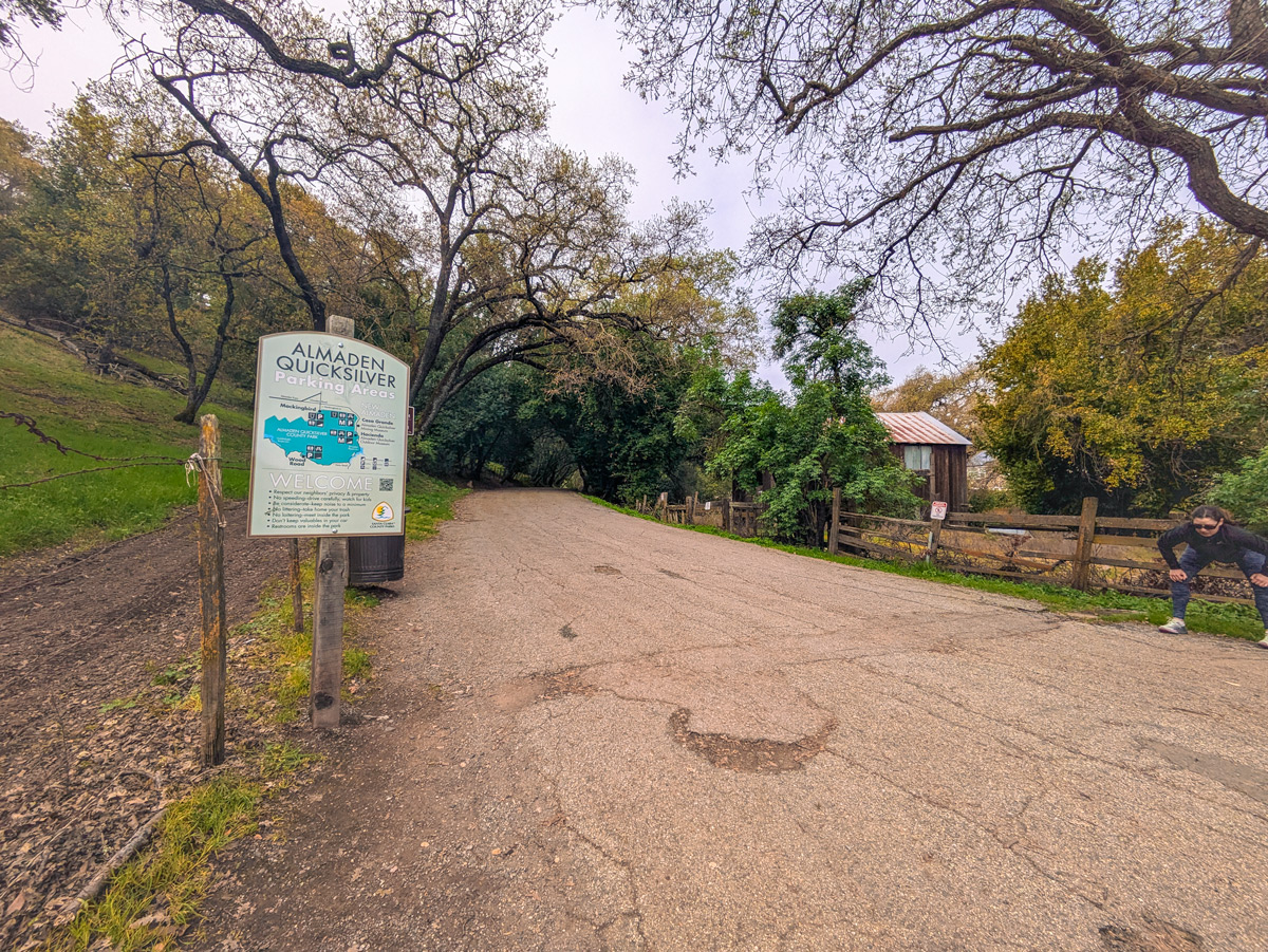
The first 1/4 mile of the trail into the park is a wide, paved road. There are porta potties located at the first junction of Mine Hill Trail and Senador Mine Trail.
Five-mile hike at Almaden Quicksilver County Park
For a moderate five-mile hike, take a left at the porta potties on to Mine Hill Trail. The bottom of Mine Hill Trail takes you through some Bay Laurel woodlands before climbing up to oak woodland and grassland views. The slopes for this trail vary between slight to moderate. Much of this hike is through open oak woodland and grassland habitat so there is very little shade.

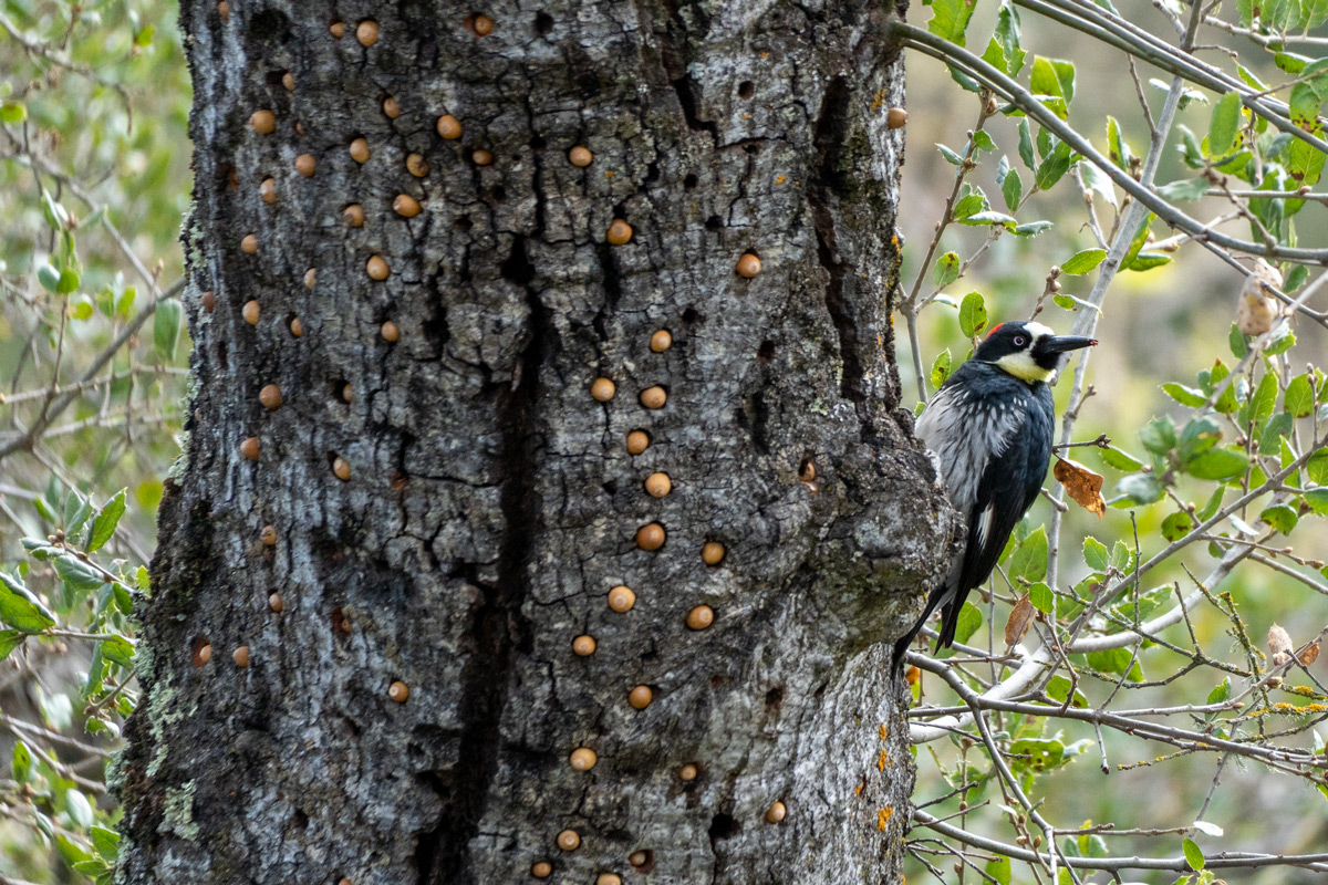
Stay on Mine Hill Trail until you reach the junction marked by a mature oak tree and information sign. Take the middle trail located to the right of the oak tree onto Guadalupe trail. The first part of this trail is a gentle hike that has a slight incline before descending down to parallel Guadalupe Creek. The mature oak trees in this woodland area are busy with acorn woodpeckers tending to their granaries.
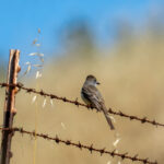
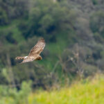
The snags and trees in this area are also popular sunning spots for turkey vultures to spread their wings. Known as the horaltic pose, this pose helps vultures to dry off and to warm up their wings, especially after a rain shower or a cold night.

Further along, Guadalupe Trail has the steepest climb on this hike as you approach Guadalupe Reservoir on your right. Right before the ascent is a short shaded section of the trail through bay laurel trees. While acorn woodpeckers with their noisy ‘waka, waka, waka’ calls are the most obvious woodpeckers in the park, these trees are home to hairy woodpeckers with their quieter calls.

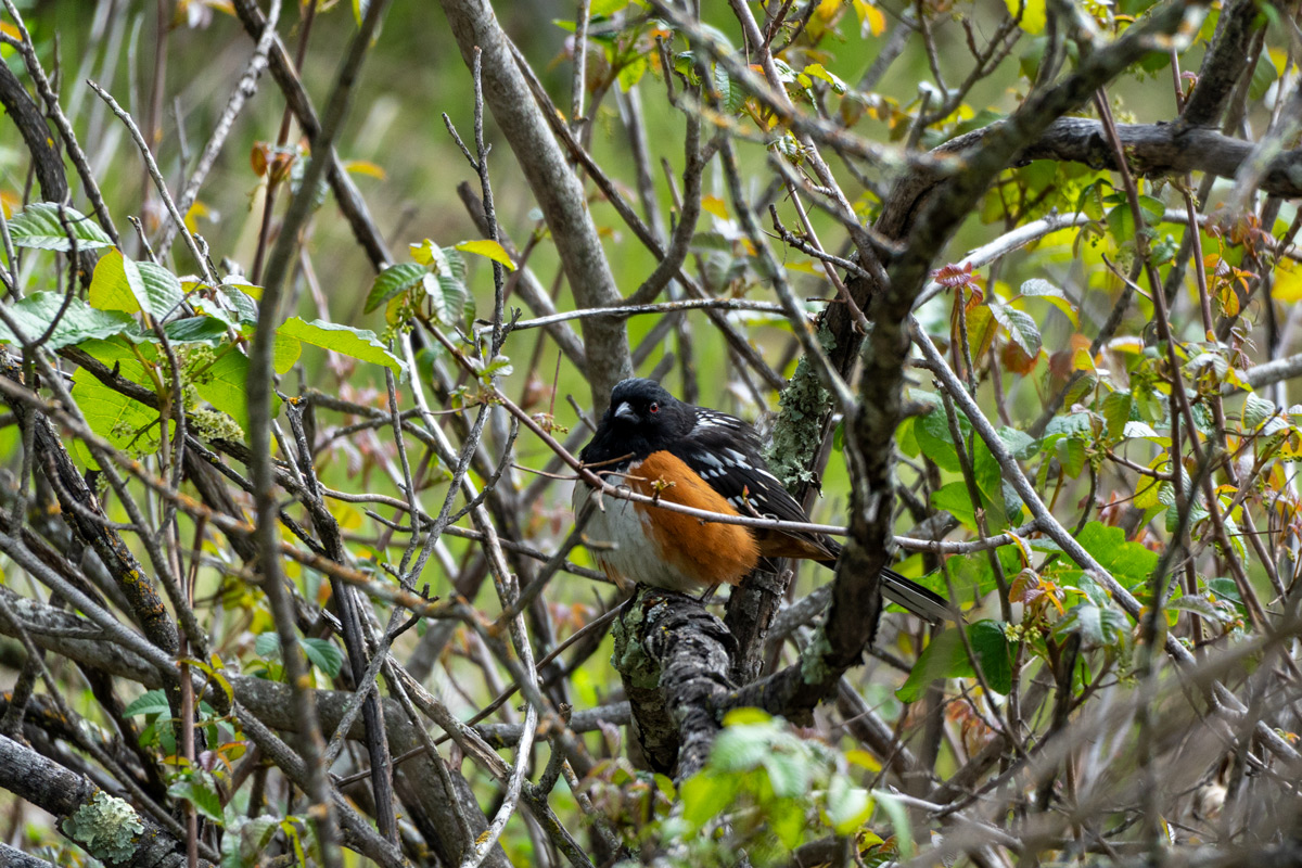
Continue on past the reservoir – you will see manzanitas among the chaparral on your left. California scrub jays and spotted towhees are often calling from these shrubs. Just beyond the chaparral, oak woodland continues with acorn woodpeckers busy tending to their granaries.
At the junction, take a sharp left to return to Mine Hill Trail. While most of the hike up to this point is unshaded, this section of Mine Hill Trail descends back down into the bay laurel forests. Steller’s jays screech noisily from the trees in this area.

Stay to the left to remain on Mine Hill Trail at the Cinnabar Trail junction (Cinnabar Trail is a single-track hiker only trail that descends down to connect with the New Almaden Trail). Continue to descend on Mine Hill Trail until you reach the porta potties again. Then turn right to walk down the paved road back to the McAbee Road entrance.