Thornewood Preserve, near Woodside, is one of Midpeninsula Regional Open Space’s smaller preserves. Located on the eastern slopes of the Santa Cruz Mountains, the 167-acre preserve features two 0.75 mile-long trails.
Thorneword was originally part of the summer estate of San Franciscan Julian Thorne and his wife, Edna, who purchased the land in 1908. After the land was donated to the Sierra Club, Midpen was gifted the preserve in 1979. Part of the original estate is still closed to the public.
Thornewood is one of the few Midpen preserves that allows dogs on a leash. The trail is also open to equestrians. There are no bathroom facilities at this preserve.
Parking at Thornewood Preserve
The main entrance to Thornewood is off La Honda Road (Highway 84). Take the single lane road past the brick entrance about a third of a mile to the small parking lot. This lot is pretty small – with only five regular slots and one ADA slot and three informal parallel parking spots.

There is a second entrance on the south side of the preserve off Old Honda Road with another 8-10 roadside spaces for hikers to park.
Parking on both ends of Thornewood fills up quickly on the weekends so get to the preserve by 9am to avoid having to wait for a space to open up.
Hiking in Thornewood Preserve
The hike through Thornewood is a turnaround hike between the La Honda Road trailhead and the Old La Honda Road Trailhead. This is a short roughly 3-mile out and back hike with a moderate elevation gradient. There is about 200 meters of elevation difference (650 feet) between the two trailheads. If you start at the Schilling Lake Trail off La Honda Road, you will descend first and have an ascent for the hike back. So, if you prefer to hike up first and descend on the way back, park at the Old La Honda Road and start with the Bridle trailhead.
Schilling Trail
The first section of Schilling Lake Trail from the La Honda Road entrance winds through a live oak and madrone woodland for a few hundred feet. The trail quickly moves into an open trail through chaparral with views towards Palo Alto.
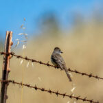
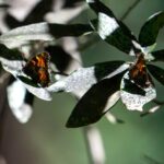
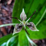
Starting in the late winter and last into the start of summer, the upper portion of Schilling Trail is lined with the deep red and pink flowers of warrior’s plume (Pedicularis densiflora) and the blue and purple flowers of the western hound’s tongue (Cynoglossum grande). American robins flock in large groups during the winter to take advantage of the crop of bright red toyon berries growing in the chaparral.

The trail continues to descend where it connects with Bridle Trail. Stay to the right to continue on Schilling Lake Trail down to Schilling Lake, named after the spice company. This lake is slowly undergoing the process of succession, and will eventually evolve from the current marsh-like meadow to a forest.

The maintained section of Schilling Lake Trail ends with a fallen log on the southeast end of the lake. Those with a more adventurous spirit can scramble over the log and continue on this unmaintained trail which connects to the lower section of Bridle Trail.

Bridle Trail
For those that prefer a more surefooted hike, turn around and head back up Schilling Trail to where the junction with the start of Bridle Trail is. Bridle Trail is another 0.75 mile trail segment that descends into a second-growth redwood forest to connect with the trailhead at Old La Honda Road. Bridle Trail is a mostly single-track compact dirt trail that zig zags down through the fern and California Bay understory before meeting up with Dennis Martin Creek.

As Bridle Trail winds down into the redwood forest, the sounds of Dennis Martin Creek can be heard. Dennis Martin Creek was named after the logger who built sawmills along the creek in the 1850s. Bridle Trail flows along Dennis Martin Creek until just before the trail head. A stone and concrete pathway guides hikers across the creek.

The creek crossing is pretty much the turnaround point to head back up to the Schilling Lake Trail parking lot. Technically, this hike can be turned into a loop hike by taking the unmaintained trail at the junction above 0.5 miles north of the creek crossing. This trail section heads slightly south and west to connect to the southern end of Schilling Lake Trail.